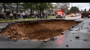
Testing for sinkholes involves systematic observation of key warning signs and professional assessment methods. Initial indicators include circular ground depressions, foundation cracks, vegetation stress patterns, and changes in water drainage. Detection requires specialized equipment like Ground Penetrating Radar (GPR), electrical resistivity profiling, and LIDAR systems for subsurface visualization. Field testing encompasses soil stability analysis, Standard Penetration Testing (SPT), and geophysical surveys. Understanding the complete detection process reveals critical strategies for property protection.
Key Takeaways
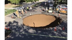
- Look for visible ground depressions, cracks in foundations, uneven floors, and misaligned doors or windows around your property.
- Conduct Ground Penetrating Radar (GPR) surveys to visualize underground voids and anomalies up to 30 feet deep.
- Test soil stability through Standard Penetration Testing (SPT) and Cone Penetration Testing (CPT) to assess subsurface composition.
- Monitor changes in vegetation patterns, water drainage irregularities, and sudden drops in groundwater levels.
- Hire licensed geologists to perform professional site investigations using specialized equipment and analysis techniques.
Understanding the Warning Signs of Sinkhole Formation
Identifying potential sinkhole formation requires careful observation of specific warning signs across multiple environmental and structural indicators. This includes monitoring changes in soil moisture, unusual plant growth patterns, and the presence of depressions or cracks in the ground. Additionally, structural elements such as shifts in foundations, walls, or road surfaces can indicate underlying instability. By keeping an eye out for these signs of sinkhole development, property owners can take proactive measures to mitigate potential risks.
Primary detection methods include monitoring ground surface deformations, particularly circular depressions and localized subsidence patterns. These manifestations often indicate underground void development, one of the primary sinkhole causes. Regular monitoring reveals that weak carbonic acid gradually dissolves underlying limestone, accelerating void formation.
Structural indicators manifest through foundation deterioration, including cracks, uneven floors, and misaligned doors or windows.
Environmental markers encompass vegetation stress patterns, abnormal water drainage behavior, and sudden changes in local hydrology. The presence of circular lakes or persistent puddles, especially in areas with limestone bedrock, warrants investigation.
Changes in well water turbidity and unexpected drops in groundwater levels can signal developing sinkholes. Additionally, the existence of similar formations in adjacent properties increases the likelihood of sinkhole development, as these geological features often occur in clusters due to shared subsurface conditions.
Essential Tools and Equipment for Sinkhole Detection

Modern sinkhole detection relies on a complete array of specialized tools and advanced technological equipment. Professional geologists employ both aerial and ground-based techniques for extensive geological surveys. Aerial photography, combined with Digital Elevation Model (DEM) tiles, enables preliminary sinkhole mapping and identification of surface depressions.
Ground-based detection methods incorporate sophisticated geophysical instruments, including electrical resistivity profiling and microgravity measurements. Weak carbonic acid formed from rainwater and carbon dioxide slowly dissolves limestone beneath the surface, creating voids. These tools detect subsurface voids and density variations indicative of potential sinkholes. Ground Penetrating Radar (GPR) systems, coupled with specialized software, provide detailed subsurface visualization.
The Sinkhole Extractor Tool, integrated with geographic information systems, processes LiDAR data for automated detection of depression features. Licensed geologists utilize this equipment alongside their expertise to conduct thorough site investigations, analyze data patterns, and generate detailed reports detailing subsurface conditions and potential hazards.
This systematic approach guarantees accurate sinkhole identification and risk assessment.
Ground Penetrating Radar (GPR) Survey Methods

Ground penetrating radar surveys require systematic setup of equipment in an orthogonal grid pattern with parallel scan lines to guarantee thorough coverage of the target area.
The analysis of GPR signals focuses on identifying anomalies and wave reflection patterns that indicate subsurface voids, with data processed through specialized software to generate 3D visualizations of underground features.
Selection of appropriate antenna frequencies is critical, as lower frequencies (200 MHz) provide greater depth penetration while higher frequencies (400-800 MHz) deliver enhanced resolution for detailed mapping of shallower features.
Professional Geologists with Master's degrees conduct all GPR surveys to ensure accurate interpretation of subsurface conditions.
GPR Equipment Setup Steps
Proper setup of GPR equipment requires systematic assembly and configuration of multiple components to secure accurate subsurface detection. The process involves careful GPR calibration techniques, beginning with connecting the control unit to an appropriately selected antenna frequency. Operators must adjust the dielectric constant and configure time gain settings to optimize signal clarity.
| Setup Phase | Key Actions | Critical Parameters |
|---|---|---|
| Assembly | Connect antenna to control unit | Cable integrity check |
| Calibration | Adjust dielectric settings | Time/linear gain values |
| Configuration | Select antenna frequency | Target depth assessment |
System initialization concludes with antenna frequency selection based on survey requirements, where higher frequencies (>400 MHz) suit shallow investigations, while lower frequencies (<200 MHz) enable deeper penetration. Proper power supply connection and verification of all system components secure reliable data acquisition during sinkhole detection surveys.
Signal Analysis For Voids
Effective signal analysis for void detection through GPR requires systematic interpretation of electromagnetic wave reflections from subsurface anomalies. The analysis focuses on identifying strong reflections caused by dielectric constant differences between voids and surrounding materials, typically appearing as black lines with white centers in radar images.
Digital processing methods enhance void detection methods through multiple stages of analysis. These include binarization, corrosion, expansion, and connected area inspection.
Three-dimensional matching tests validate suspected void areas by examining adjacent longitudinal sections, requiring over 50% correlation for confirmation. Advanced radar signal analysis employs automated interpretation algorithms using support vector machines or cascade convolutional neural networks, achieving accuracy rates exceeding 90% when properly calibrated.
The success of void detection depends greatly on data quality and proper interpretation of reflection coefficients at material interfaces.
Depth Range And Frequencies
Building upon signal analysis methods, the selection of appropriate GPR frequencies determines survey depth capabilities and resolution quality. Frequency selection directly impacts radar penetration depth, with lower frequencies reaching up to 30 feet in resistive materials while higher frequencies achieve depths under 9 feet but offer superior resolution.
Key considerations for ideal depth range assessment include:
- 200 MHz antennas penetrate deeper subsurface layers, essential for detecting large voids and geological structures.
- 400 MHz frequencies provide enhanced resolution for shallow targets and smaller anomalies.
- Dual-frequency systems (300/800 MHz) enable thorough coverage by combining depth capability with detailed imaging.
The effectiveness of GPR surveys relies on matching antenna frequencies to specific site conditions and target characteristics, ensuring accurate subsurface mapping and void detection through methodical data collection and analysis.
Field Testing Techniques for Soil Stability

Detecting potential sinkholes requires systematic field testing techniques to evaluate soil stability and assess subsurface conditions.
Geotechnical analysis incorporates multiple methods to determine structural integrity and identify sinkhole indicators. Primary techniques include soil aggregate testing through slake tests and stability assessments that measure erosion resistance and soil cohesion.
Standard Penetration Testing (SPT) and Cone Penetration Testing (CPT) provide critical data about soil resistance values and subsurface composition. These methods enable engineers to develop risk assessment profiles by analyzing soil behavior patterns and potential failure zones.
Geophysical investigations, including rock coring and air rotary drilling, detect subsurface voids and assess bedrock continuity.
Advanced analytical tools such as limit equilibrium analysis and finite element modeling evaluate slope stability and calculate safety factors against soil collapse.
High-resolution groundwater mapping and raveling charts derived from CPT data further enhance the assessment of sinkhole vulnerability in susceptible areas.
Advanced Remote Sensing Technologies

Advanced remote sensing technologies combine LIDAR surface change detection, thermal imaging methods, and multi-sensor data integration to provide thorough sinkhole analysis capabilities.
LIDAR systems detect minute surface deformations through high-precision elevation measurements, while thermal imaging identifies subsurface anomalies through temperature variation mapping.
The integration of multiple sensor data streams, including InSAR and optical imagery, enables validation of potential sinkhole locations through cross-referencing of various detection parameters.
LIDAR Surface Change Detection
LIDAR technology stands as one of the most effective remote sensing methods for sinkhole detection, offering up to four times greater accuracy compared to traditional InSAR approaches. The process involves analyzing surface modeling data captured through airborne LIDAR systems, which deliver high-precision measurements of ground elevations and depressions.
Critical advantages of LIDAR-based detection include:
- Superior detection rates for active sinkholes through advanced surface change analysis
- Fast processing of open-access data for immediate risk assessment
- Enhanced capability to identify subtle ground deformation patterns
The methodology requires preprocessing raw point cloud data into manageable tiles before generating a thorough digital elevation model (DEM).
This surface modeling approach enables precise identification of elevation changes and potential sinkhole formations, making it invaluable for infrastructure planning and risk management strategies.
Thermal Imaging Breakthrough Methods
Recent breakthroughs in thermal imaging technology have revolutionized sinkhole detection through the integration of unmanned aerial systems (UAS) equipped with high-resolution infrared cameras.
These thermal techniques utilize infrared applications to identify temperature anomalies caused by subsurface voids and structural discontinuities.
The methodology relies on analyzing thermal gradients created when subsurface voids disrupt normal heat flow patterns through the ground.
Advanced subsurface imaging processes, including pulse-phase thermography (PPT) and sparse-principal component thermography (S-PCT), enhance detection accuracy by filtering out environmental noise.
The UAS-AIR_T method has proven particularly effective, offering advantages over traditional ground-penetrating radar in certain scenarios.
This approach enables systematic scanning of large areas while capturing subtle temperature variations that indicate potential sinkhole formation, making it an invaluable tool for early detection and risk assessment.
Multi-Sensor Data Integration
The integration of multiple remote sensing technologies has emerged as a powerful methodology for thorough sinkhole detection and monitoring. Advanced sensor fusion techniques combine data from LiDAR, InSAR, and ground-penetrating radar to create extensive subsurface analyses. Through sophisticated data visualization methods, analysts can interpret complex patterns and identify potential hazards with unprecedented accuracy.
- Real-time monitoring systems now detect millimeter-level ground movements, enabling early warning of impending collapses.
- Multi-temporal analysis reveals subtle surface deformations that could indicate developing sinkholes.
- Permanent artificial corner reflectors enhance measurement precision, reducing false positives.
The implementation of multi-sensor integration overcomes individual technology limitations while maximizing detection capabilities. By combining satellite imagery, electromagnetic measurements, and ground-based observations, engineers can develop more reliable risk assessments and mitigation strategies for vulnerable areas.
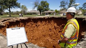
Professional Assessment and Expert Analysis

Professional assessment of potential sinkhole sites requires sophisticated geophysical methods and thorough site investigation techniques to accurately evaluate subsurface conditions. Ground penetrating radar, electromagnetic conductivity surveys, and seismic refraction provide essential data about underground anomalies. These geophysical techniques can detect voids and subsurface features up to 30 feet below ground level.
Site investigation incorporates soil borings, Standard Penetration Tests, and Cone Penetrometer Soundings to analyze soil and rock properties. Continuous monitoring through piezometers and groundwater devices helps detect early warning signs of developing sinkholes.
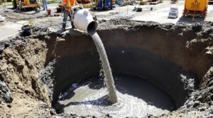
Professional geotechnical engineers analyze the collected data to determine appropriate sinkhole remediation strategies, which may include pressure grouting or structural underpinning. This extensive assessment process integrates multiple data sources, including laboratory soil classification results and structural monitoring data, enabling experts to formulate effective solutions based on site-specific conditions and risk factors.
Documentation and Reporting Protocols

Proper documentation of sinkhole occurrences requires systematic reporting protocols and thorough record-keeping procedures to guarantee effective management and mitigation. The documentation requirements encompass detailed plan views, topographic information, and photographic evidence of the affected area.
Geological investigations must be conducted and documented to assess potential impacts on groundwater systems and surface stability.
Critical reporting procedures include:
- Immediate notification of local law enforcement and environmental agencies to assure public safety
- Detailed documentation of site-specific considerations, including depth to bedrock and drainage patterns
- Implementation of ongoing monitoring protocols with periodic inspection reports
All documentation must comply with federal, state, and local regulations, while being supervised by qualified geologists. The reporting system should maintain records of treatment measures, their effectiveness, and any subsequent modifications.
Special attention must be given to conservation requirements and the establishment of proper hydraulic equilibrium during remediation efforts.
Prevention and Ongoing Monitoring Strategies

Implementing thorough prevention and monitoring strategies plays an essential role in mitigating sinkhole risks and maintaining ground stability. These strategies encompass regular infrastructure inspections, advanced detection systems, and extensive water management protocols.
Effective sinkhole prevention begins with systematic infrastructure maintenance, utilizing ground-penetrating radar and acoustic leak detection to identify subsurface anomalies. Organizations must conduct routine inspections of underground utilities while implementing sophisticated monitoring techniques, including seismic sensors and optical fiber systems that detect ground movements in real-time.
Water management represents a critical component of prevention, requiring properly designed drainage systems and the strategic use of permeable materials to regulate groundwater levels. Additionally, stringent zoning regulations and construction codes in karst-prone areas help minimize risk.
These measures, combined with continuous monitoring through advanced detection systems, create a multi-layered approach to identifying and addressing potential sinkhole formation before critical issues develop.
The Benefits Of Consulting A Public Adjuster

When dealing with potential sinkhole damage, consulting a public adjuster provides essential expertise in managing complex insurance claims and securing appropriate compensation.
Professional adjusters conduct objective assessments of structural damage, ground deformation, and other sinkhole-related issues, documenting findings with technical precision to support claims.
Their involvement typically results in more thorough claim settlements through methodical processing of documentation and skillful negotiation with insurance providers.
Studies show that working with licensed public adjusters can increase settlement amounts by up to 500% for non-catastrophic property damage claims.
Expertise In Insurance Claims
Consulting a public adjuster provides homeowners with essential expertise in maneuvering complex sinkhole insurance claims. Through thorough insurance policy analysis, these professionals interpret intricate policy language and identify critical coverage elements that property owners might otherwise overlook. Their expertise enables effective claim negotiation strategies with insurance carriers, often resulting in considerably higher settlement amounts.
- Public adjusters possess specialized knowledge of policy loopholes and exclusions specific to sinkhole damage.
- They systematically document and validate all structural damage through meticulous evidence collection.
- Their negotiation expertise counteracts insurance company tactics designed to minimize claim payouts.
These professionals manage the extensive documentation requirements while ensuring claims are presented accurately and thoroughly.
Their involvement proves particularly valuable when dealing with complex sinkhole scenarios involving multiple policies or disputed damage assessments.
Operating on contingency fee basis, public adjusters typically charge between 5-20% of the final settlement amount, making their services accessible to most homeowners.
Objective Damage Assessment
Professional public adjusters deliver objective damage assessments through systematic evaluation protocols and scientific testing methodologies.
Their approach integrates thorough inspection techniques with advanced geological risk assessment procedures to quantify structural impacts accurately.
The assessment process employs both destructive and non-destructive testing methods, incorporating specialized equipment like ground-penetrating radar to evaluate subsurface conditions.
Public adjusters systematically document findings through detailed property inspections, photographic evidence, and expert evaluations.
This scientific approach enables the development of effective sinkhole mitigation strategies based on concrete data.
Unlike insurance adjusters who may conduct profit-driven assessments, public adjusters provide comprehensive evaluations focused solely on the policyholder's interests.
Streamlined Claim Process
A considerable advantage of engaging public adjusters lies in their ability to streamline the complex insurance claims process through systematic management protocols. Their expertise facilitates claim efficiency through meticulous documentation management, deadline adherence, and expert navigation of technical requirements. Public adjusters provide professional representation, ensuring all communications with insurance companies are handled strategically.
- They execute thorough damage assessments while managing all paperwork, enabling stress reduction for property owners.
- Their systematic approach expedites claim resolution through strategic negotiation and technical expertise.
- Professional adjusters serve as dedicated advocates, ensuring fair settlements while allowing property owners to focus on recovery.
This methodical management of the claims process, combined with their professional expertise, greatly enhances the likelihood of ideal claim outcomes while minimizing policyholder involvement. With settlement fees ranging from 5% to 15%, public adjusters often secure significantly higher compensation that justifies their cost.
Higher Claim Payouts & Settlements
Engaging public adjusters for insurance claims consistently yields substantially higher settlements compared to policyholder-managed claims. Their specialized knowledge of policy interpretations and claim strategies enables extensive documentation of all covered damages, ensuring maximum compensation potential.
Through expert negotiation tactics, public adjusters leverage their understanding of insurance protocols to secure ideal settlements. Operating on a contingency fee basis, typically ranging from 10% of the final settlement, public adjusters are inherently motivated to maximize claim payouts.
Their professional expertise particularly benefits complex cases involving multiple damage types, where thorough assessments and detailed documentation are essential. By managing all aspects of the claims process, from initial documentation to final settlement negotiations, public adjusters provide objective representation while alleviating the emotional and administrative burden from policyholders. With only 5% of policyholders aware of public adjusters' existence, many miss opportunities for maximizing their insurance claims.
About The Public Claims Adjusters Network (PCAN)

The Public Claims Adjusters Network (PCAN) operates as a consortium of state-licensed professionals who specialize in representing policyholders throughout the insurance claims process. Their extensive services encompass loss documentation, market expertise, and total cost analysis, guaranteeing optimal claim settlements through skilled negotiation with carriers.
PCAN's service model delivers:
- Remote claim management capabilities for efficient assessment and processing
- Customized solutions tailored to unique operational challenges
- Immediate support through dedicated call centers for first notice of loss
Public Adjusters within PCAN maintain strict compliance with regulatory requirements, including Insurance Department-approved contracts and transparent fee disclosure protocols.
Their expertise extends across both routine and catastrophic claims, supported by principals with decades of industry experience. Claims representation through PCAN follows established documentation standards, requiring detailed loss estimates and written communication of settlement offers to guarantee procedural integrity and optimal outcomes for policyholders.
Frequently Asked Questions
Can Sinkholes Form in Areas Without Limestone or Karst Geology?
While true sinkhole formation requires karst geology, depressions resembling sinkholes can develop in non-karst areas due to geological factors like collapsed underground structures, rotted stumps, or human activities.
How Long Does It Typically Take for a Sinkhole to Fully Develop?
Sinkhole formation varies greatly based on geological factors, ranging from rapid development within minutes to hours for collapse sinkholes, to gradual progression over months or years for cover-subsidence types.
Are There Specific Insurance Policies That Cover Sinkhole Damage?
Specialized sinkhole coverage can be added to homeowners insurance policies, with mandatory offerings in Florida and Tennessee. These policies address structural damage and insurance claims related to verified sinkhole activity.
Do Filled or Repaired Sinkholes Typically Reopen in the Future?
Filled sinkholes may reopen depending on geological stability, repair methods, and environmental conditions. Professional sinkhole repair using modern techniques like grout or foam minimizes reopening risks but requires ongoing monitoring.
How Deep Can Residential Sinkholes Typically Extend Underground?
Residential sinkholes typically extend from several inches to 100 meters underground, with sinkhole depth varying based on geological conditions, bedrock composition, and groundwater dynamics, greatly impacting structural stability and property safety.
References
- https://geomodel.com/applications/sinkhole-void-detection/
- https://geo-sense.com/wp-content/uploads/2020/10/using-combined-closerange-active-and-passive-remote-sensingmethods-to-detect-sinkholes-2469-4134-1000222.pdf
- https://www.groundpenetratingradar.co.uk/news/sinkhole-detection/
- https://patents.google.com/patent/US10372128B2/en
- https://www.enviroprobe.com/sinkhole-locating
- https://www.agiusa.com/blog/7-most-common-signs-sinkholes
- https://geologyscience.com/natural-hazards/sinkhole/
- https://www.agiusa.com/7-common-signs-of-sinkholes-how-to-test-for-them
- https://concretesolutionsofatl.com/7-signs-your-house-may-have-a-sinkhole-problem/
- https://floridadep.gov/fgs/sinkholes/content/sinkhole-faq