Tornadoes develop when specific atmospheric conditions combine, requiring unstable air masses and significant wind shear. The process begins as warm, moist surface air interacts with cooler, drier air aloft, creating powerful updrafts exceeding 100 mph. Wind shear transforms horizontal rotation into vertical rotation within supercell thunderstorms, eventually forming the characteristic funnel cloud. Understanding the complex interplay of these meteorological factors reveals nature's most violent storms.
Key Takeaways
- Tornadoes form when warm, moist surface air collides with cooler, drier air aloft, creating atmospheric instability.
- Strong wind shear causes horizontal rotation in the atmosphere, which then tilts vertically through powerful updrafts.
- Supercell thunderstorms develop rotating updrafts called mesocyclones, which can exceed speeds of 100 mph.
- The tornado funnel forms when intense rotation within the mesocyclone concentrates and extends downward from the storm base.
- The visible funnel cloud appears when rotating air becomes concentrated enough to condense moisture and lift surface debris.
The Perfect Storm Conditions
Before a tornado can form, specific atmospheric conditions must align to create the perfect environment for these powerful storms. The fundamental requirements include the presence of instability and significant wind shear in the atmosphere. This combination occurs when warm, moist air near the surface interacts with cooler, drier air aloft, creating the instability necessary for severe thunderstorm development.
The critical factor in tornado formation is the presence of wind shear, where wind speeds and directions change dramatically with height. Typically, a difference of 50 mph between surface winds and those at 18,000 feet is required. This variation creates the rotation necessary for supercell development, making atmospheric pressure differences particularly significant in tornado forecasting. These conditions are most common in Tornado Alley states, which experience approximately 1,200 tornadoes annually.
The resulting mesocyclone, a rotating column of air that can extend several miles into the sky, becomes the primary mechanism for potential tornado formation as it interacts with unstable air masses.
From Warm Air to Towering Clouds

The transformation from warm air to towering storm clouds begins with a fundamental thermal process at ground level. As the sun heats the earth's surface, it creates pockets of warm air that experience thermal uplift due to their buoyancy relative to the surrounding cooler air.
These rising columns of warm air, known as thermals, initiate the cloud formation process. When these thermals encounter colder air aloft, the temperature contrast creates atmospheric instability.
This instability fuels powerful updrafts, particularly in supercell thunderstorms, where the rising air rapidly cools and condenses. The process intensifies as water vapor condenses and freezes, releasing additional heat that accelerates the upward motion. The strength of these updrafts depends heavily on the rapid temperature decrease with height.
In environments with strong vertical wind shear, these updrafts can begin to rotate, developing into mesocyclones. This rotation becomes a critical component in the potential formation of severe storms and, under specific conditions, tornadoes.
Understanding Wind Shear's Role

Wind shear patterns in the atmosphere establish the vital vertical conditions needed for tornado formation, with significant changes in wind speed and direction occurring at different heights.
The interaction between varying wind speeds and directions creates horizontal rotation in the atmosphere, particularly when wind direction changes approximately 90 degrees between the surface and 18,000 feet.
This horizontal rotation, when combined with strong updrafts in a thunderstorm, can transform into the vertical rotation characteristic of tornadic activity. Low pressure systems in areas like southwestern Iowa create ideal conditions for tornado development, with winds flowing counterclockwise around the center.
Vertical Shear Patterns
Among the most essential factors in tornado formation, vertical wind shear patterns play a fundamental role in determining both storm structure and tornadic potential.
The two primary vertical shear types – speed shear and directional shear – create distinct atmospheric conditions that influence tornado development. Strong directional wind shear occurs in the lower atmosphere during prime tornado conditions. Ideal conditions typically occur when winds shift approximately 90 degrees between the surface and 18,000 feet altitude.
Different shear profiles correspond to specific storm structures. While deep-layer shear (0-6 km) helps predict overall storm organization, lower-level shear, particularly in the lowest 500 meters, serves as a more reliable indicator of tornado potential.
Hodograph shapes provide vital information about potential storm behavior, with curved patterns suggesting right-moving supercells conducive to tornadogenesis, while straight patterns typically indicate splitting storms.
Horizontal Rotation Development
While horizontal vorticity exists naturally in the atmosphere due to wind shear, its transformation into vertical rotation marks a critical phase in tornado formation.
The horizontal vorticity dynamics involve streamwise vorticity, where the local rotation axis aligns with storm-relative inflow winds. This alignment proves essential for mesocyclone formation as the supercell's updraft tilts the horizontal rotation into the vertical plane. The significant speed and directional wind shear is a fundamental requirement for this process to occur.
Environmental conditions featuring large streamwise vorticity support more robust low-level mesocyclones.
Though this tilting process does not directly generate vertical vorticity at the surface, it establishes the foundation for mesocyclone development aloft. The process intensifies when stronger wind shear exists with height, creating more pronounced horizontal rotation that can evolve into the powerful vertical circulation characteristic of tornadic storms.
Birth of the Supercell

The birth of a supercell thunderstorm requires specific atmospheric conditions to align precisely. Supercell dynamics depend on unstable atmospheric conditions where warm, humid surface air meets rapidly cooling upper layers. The critical updraft mechanics involve wind shear, both in speed and direction, which creates the essential rotating motion that defines these powerful storms.
| Component | Characteristic |
|---|---|
| Wind Shear | Speed and direction change with height |
| Temperature | Rapid decrease with altitude |
| Moisture | High humidity near surface |
| Updraft Speed | Can exceed 100 mph |
| Vortex Formation | Horizontal rotation tilts vertical |
As these conditions converge, the storm's updraft lifts and tilts the horizontal vortex tube into a vertical position. This process transforms the standard thunderstorm into a rotating supercell, characterized by its persistent mesocyclone and potential for severe weather. The flanking line of new updrafts helps maintain the system's longevity and intensity.
Anatomy of a Rotating Storm

Supercells possess distinct structural components that work in concert to create nature's most powerful thunderstorms. The foundation of supercell dynamics lies in its rotating updrafts, specifically the mesocyclone, which forms through the tilting of horizontal vorticity. This powerful rotation system creates several distinctive features that meteorologists use to identify and track these storms.
Key structural elements include:
- The anvil cloud at -30°C, formed when the updraft meets the tropopause
- A wall cloud beneath the storm base, often rotating and potentially spawning tornadoes
- Forward flank downdraft (FFD) carrying heavy precipitation
- Rear flank downdraft (RFD) wrapping around the mesocyclone
- The clear slot, creating a characteristic horseshoe pattern
These components manifest visible radar signatures, including the hook echo, bounded weak echo region (BWER), and V-notch, which help meteorologists assess storm intensity and tornado potential.
The presence of these features often triggers severe weather warnings and indicates the need for immediate public safety measures.
When the Funnel Touches Down

During a tornado's formation, descending funnel clouds mark the significant shift between severe thunderstorm conditions and tornadic activity. The funnel cloud dynamics involve a visible condensation column extending from the thunderstorm base, composed of water droplets that indicate the tornado formation process is underway.
The change occurs when the rear flank downdraft reaches ground level, coinciding with the funnel's descent. This process typically manifests through visible indicators, including a debris cloud at the surface, even when the funnel itself remains partially transparent.
The interaction between warm updrafts and cool downdrafts creates the necessary conditions for the funnel to make ground contact, officially becoming a tornado.
An important aspect of this phenomenon is that tornadoes can exist without a fully condensed funnel, as the presence of surface debris often provides the first indication of touchdown.
The tornado derives its energy from the parent cloud above, maintaining its structure through continuous air circulation until the rear flank downdraft eventually disrupts this flow.
Life and Death of a Tornado

The formation of a tornado's funnel begins as rotating air within the mesocyclone tightens and descends, initially appearing as a condensation funnel extending from the storm's base.
Within the storm's core, the intensifying vortex creates powerful updrafts and downdrafts that concentrate the rotation, leading to the fully-developed tornado touching ground with maximum destructive potential.
The tornado's final moments occur when cold downdrafts wrap around the vortex, cutting off its warm air supply and causing the funnel to rope out into a thin, contorted shape before complete dissipation.
Birth of the Funnel
When warm air near the ground begins to rise, it initiates a complex sequence of atmospheric events that can culminate in tornado formation. The process of funnel formation requires specific atmospheric conditions, particularly within supercell thunderstorms that exhibit strong vertical wind shear.
Key components in tornado genesis include:
- Formation of shallow cumulus clouds from rising warm air
- Development of deep cumulus and cumulonimbus clouds in unstable conditions
- Creation of a rotating updraft due to wind shear
- Establishment of a mesocyclone several kilometers up
- Convergence of warm updrafts and cool downdrafts
The rotating updraft becomes tilted vertically by powerful atmospheric forces, creating the characteristic spinning motion.
This rotation, combined with the rear flank downdraft, focuses the mesocyclone and initiates the development of the visible funnel structure.
Inside the Storm's Core
Deep within a mature tornado's structure lies an intricate system of interacting air flows and pressure gradients that define its devastating power.
The tornado dynamics center around a low-pressure cylindrical core, encircled by maximum tangential winds where air converges through the inflow boundary layer into the violent corner region.
The core characteristics include a central funnel cloud comprising water droplets, which typically measures only one-tenth of the overall circulation diameter.
Around this core, vertical speeds in the central jet can reach 300 km/h, while radial speeds approaching 180 km/h occur as air moves from the inflow to corner regions.
This complex structure merges with the parent thunderstorm's updraft aloft, while a weakly swirling outer flow surrounds the entire system.
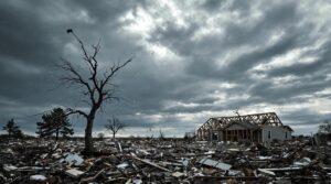
Final Deadly Moments
Understanding a tornado's complete life cycle reveals how these violent storms ultimately meet their end. During its final moments, a tornado undergoes significant transformations before dissipating. The process typically begins when the rear flank downdraft (RFD) wraps around the vortex, gradually choking off its warm air supply and destabilizing its structure.
Key characteristics of a tornado's last phase include:
- Narrowing of the funnel cloud into a rope-like shape
- Tilting of the vortex from vertical to nearly horizontal
- Intensification of winds due to conservation of angular momentum
- Reduced but still dangerous damage potential
- Possible formation of new tornadoes in intense supercells
As the tornado enters its rope stage, the visible funnel becomes increasingly contorted before finally dissipating, marking the end of its path of destruction.
Warning Signs and Detection Methods

Recognizing the warning signs of an approaching tornado can mean the difference between life and death. Both visual cues and auditory signs provide essential indicators of potential tornado formation. Dark or green-tinted skies, rotating funnel clouds, and debris clouds serve as primary visual indicators, while a persistent sound resembling a freight train characterizes the distinctive auditory signature.
| Warning Type | Key Indicators |
|---|---|
| Visual | Dark/Green Sky |
| Visual | Funnel Clouds |
| Auditory | Freight Train Sound |
| Technology | Tornado Alert System |
| Official | NWS Warnings |
Modern detection methods complement traditional observation techniques. The Tornado Alert system employs advanced technology to detect tornadoes with 95% accuracy up to 30 miles away by monitoring atmospheric frequencies. The National Weather Service issues official alerts through multiple channels, distinguishing between Tornado Watches (favorable conditions) and Tornado Warnings (immediate threat). These warnings, disseminated via weather radios, apps, and emergency broadcasts, provide vital lead time for protective action.
Essential Safety Measures

Proper implementation of safety measures stands as the vital factor in surviving a tornado event. Studies of tornado preparedness tips emphasize the establishment of emergency communication plans and strategic shelter locations as foundational elements. Data shows that individuals who maintain disaster supply kits and practice shelter protocols demonstrate markedly higher survival rates during tornado incidents.
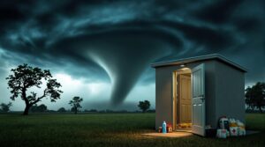
Essential tornado safety protocols include:
- Identifying basement or interior room locations on the lowest floor level
- Establishing clear family meeting points and communication methods
- Maintaining an emergency kit with water, non-perishable food, and medical supplies
- Monitoring weather alerts through multiple notification systems
- Following location-specific protocols based on building type and circumstances
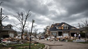
Post-tornado safety requires equal vigilance, with emphasis on protective equipment during cleanup operations.
Scientific analysis indicates that secondary injuries often occur during recovery efforts, making it vital to avoid downed power lines and exercise caution when handling debris.
Professional assessment should precede any structural repairs or heavy debris removal.
The Benefits Of Consulting A Public Adjuster

When recovering from tornado damage, consulting a public adjuster provides essential expertise in maneuvering complex insurance claims and maximizing settlement amounts through objective damage assessments.
Public adjusters streamline the claims process by handling all communications with insurance companies while thoroughly documenting structural damage, personal property losses, and additional living expenses.
Research indicates that policyholders who work with licensed public adjusters typically receive considerably higher claim settlements compared to those who handle claims independently.
Fees generally range from 10% to 20% of the final settlement amount, with costs only incurred upon successful claim outcomes.
Expertise In Insurance Claims
Maneuvering the complexities of tornado-related insurance claims requires specialized expertise that public adjusters provide. These professionals possess extensive knowledge of insurance claim strategies and policyholder rights, enabling ideal claim outcomes through systematic documentation and negotiation processes.
- In-depth understanding of policy terms and coverage limitations
- Expert interpretation of complex insurance documentation
- Strategic damage assessment and documentation procedures
- Advanced negotiation techniques with insurance carriers
- Thorough knowledge of industry regulations and standards
Public adjusters employ data-driven approaches to quantify damages, analyze policy provisions, and maximize settlement values.
Their methodical documentation processes guarantee accurate representation of losses, while their negotiation expertise counteracts common claim reduction tactics employed by insurance companies. This systematic approach greatly increases the probability of obtaining fair compensation for tornado-related damages. Operating on a contingency fee basis, public adjusters typically charge 5-20% of the final settlement amount while delivering consistently favorable outcomes for policyholders.
Objective Damage Assessment
The objectivity of damage assessment following a tornado represents a critical factor in securing appropriate insurance compensation.
Professional public adjusters employ systematic assessment strategies to document and evaluate structural damage thoroughly, ensuring unbiased documentation of all tornado-related impacts.
These specialists utilize the EF Scale methodology while gathering extensive photographic evidence from multiple angles, creating detailed reports that capture both obvious and subtle damages.
Their thorough damage documentation includes chronological records of all communications, structural assessments, and debris patterns.
Research indicates that professional adjusters can considerably increase settlement outcomes, with documented cases showing improvements up to 40% in claim values.
This systematic approach helps eliminate potential oversights while providing a scientifically sound basis for insurance negotiations.
Unlike insurance adjusters who often prioritize company interests, public adjusters operate on commission-based fees to align their objectives with achieving maximum settlements for policyholders.
Streamlined Claim Process
Building upon professional damage assessment protocols, a streamlined claims process through public adjusters greatly enhances insurance settlement efficiency and accuracy.
Modern claims technology enables automated validation, real-time tracking, and AI-driven workflow optimization, considerably reducing processing times and administrative costs. Through systematic digital platforms, public adjusters facilitate enhanced customer engagement while maintaining precise documentation standards.
- Automated verification systems minimize errors and expedite claim validation
- AI-powered fraud detection strengthens claim integrity
- Digital portals provide real-time status updates and documentation access
- Advanced analytics optimize claim processing workflows
- Paperless systems reduce storage costs and environmental impact
This technology-driven approach delivers measurable improvements in settlement accuracy, processing speed, and customer satisfaction while reducing operational expenses through elimination of manual tasks and physical documentation requirements.
The PCAN member adjusters must demonstrate a minimum of three years in business and maintain high professional standards through bi-yearly audits.
Higher Claim Payouts & Settlements
Professional analysis demonstrates that engaging public adjusters significantly increases insurance claim settlements through thorough damage assessment and skilled negotiation.
Statistical evidence indicates that claims handled by public adjusters achieve settlements averaging $22,266 compared to $18,659 without their involvement, illustrating the effectiveness of their claim strategies.
Public adjusters implement settlement maximization techniques by leveraging their specialized knowledge of insurance policies and extensive documentation methods.
Their expertise in identifying hidden damages and interpreting complex policy provisions guarantees all legitimate losses are included.
Recent case studies validate their impact, such as a tornado damage claim in Texas resulting in a 40% higher settlement through professional representation.
Working on contingency fees, these adjusters align their interests with policyholders while providing expert testimony and detailed assessment documentation.
Dwelling coverage remains a critical factor when public adjusters evaluate structural damage claims to ensure comprehensive compensation for homeowners.
About The Public Claims Adjusters Network (PCAN)

Leveraging decades of expertise, Public Claims Adjusters Network (PCAN) operates as a thorough claims management organization serving both domestic and international markets. Their extensive Public Adjuster Services encompass the entire claims lifecycle, from initial notice to final settlement, supported by experienced daily and catastrophic event adjusters.
Key aspects of PCAN's Claims Management Expertise include:
- Dedicated call center providing immediate support for first notice of loss
- Network of professional adjusters across all states
- Customized solutions for unique operational challenges
- Seamless communication throughout the claims process
- Quality-focused approach maintaining industry benchmarks
PCAN's proven track record demonstrates their ability to transform claims management through expert insights and professional service.
Their wide-ranging support system guarantees reliable outcomes while maintaining efficiency and quality standards. Client testimonials consistently highlight PCAN's commitment to professional service delivery and empathetic approach throughout the claims resolution process.
Frequently Asked Questions
Can Tornadoes Form Over Water or Only on Land?
Tornadoes can form over both water and land. When occurring over water, they are called water spouts, which exist as either fair-weather phenomena or more dangerous tornado hybrids called tornadic waterspouts.
Why Do Some States Experience More Tornadoes Than Others?
Like nature's mixing bowl, states in Tornado Alley and the Southeast experience more tornadoes due to ideal atmospheric conditions where warm Gulf air collides with cool Canadian air masses.
What's the Difference Between a Tornado Watch and Tornado Warning?
Tornado safety involves understanding two warning signals: a watch indicates possible tornado conditions over a large area, while a warning means a tornado has been spotted, requiring immediate shelter.
Can Multiple Tornadoes Occur From the Same Storm System?
Yes, storm systems, particularly supercell thunderstorms, can generate multiple tornadoes. This phenomenon, known as tornado families, occurs when conditions support repeated tornado formation within the same system.
How Do Scientists Measure and Rate Tornado Intensity?
Scientists measure tornado intensity through post-storm damage surveys, using the Enhanced Fujita Scale's standardized damage indicators and wind speed estimates to rate tornadoes from EF0 to EF5.
References
- https://www.metoffice.gov.uk/weather/learn-about/weather/types-of-weather/tornadoes/how-are-tornadoes-formed
- https://www.weather.gov/ffc/torntext
- https://www.noaa.gov/education/resource-collections/weather-atmosphere/tornadoes
- https://www.britannica.com/video/tornadoes/-226131
- https://www.nssl.noaa.gov/education/svrwx101/tornadoes/
- https://www.battlbox.com/blogs/outdoors/why-does-a-tornado-occur-understanding-the-phenomenon
- https://sites.psu.edu/pmarkowski/how-tornadoes-form/
- https://bkvenergy.com/blog/how-do-tornadoes-form/
- https://www.britannica.com/story/how-do-tornadoes-form
- https://www.groundzeroshelters.com/blog/the-science-of-tornados