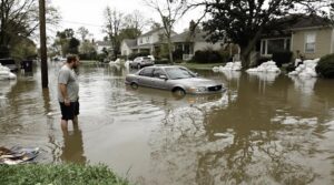
Flood insurance costs and rate maps are calculated by the National Flood Insurance Program (NFIP) using an actuarially sound method. The NFIP assesses individual property risk based on elevation, distance from flooding sources, and flood perils. Flood insurance rate maps (FIRMs) delineate Special Flood Hazard Areas (SFHAs) and Base Flood Elevations (BFEs), supporting the NFIP in offering premiums based on actual flood risks. Understanding FIRMs and rate calculations can help property owners navigate insurance requirements and optimize premium expenditures.
Key Takeaways
- Flood insurance costs are calculated based on individual property risk, including elevation and distance from flooding sources.
- Flood Insurance Rate Maps (FIRMs) delineate Special Flood Hazard Areas (SFHAs) and Base Flood Elevations (BFEs) to assess flood risk.
- Flood zone classifications (A, V, B, C, X) indicate risk levels of flooding, with A and V being high-risk zones.
- Minimum flood insurance requirements are based on the loan's outstanding principal or $250,000 for residential properties in SFHAs.
- Factors affecting flood insurance premiums include zone classification, property location, historical flood claims, and property features like elevation and flood-proofing.
Calculating Flood Insurance Costs
The National Flood Insurance Program (NFIP) employs a multifaceted approach to calculating flood insurance costs. This approach utilizes an actuarially sound method, incorporating the best available flood risk data to determine premiums. A key factor in premium calculation is individual property risk, taking into account the unique risk factors associated with each property, including elevation and distance from flooding sources. The likelihood of flood perils, such as flash flooding and coastal erosion, is also assessed. Levee performance and infrastructure are further considered in determining the overall flood risk. By accounting for these variables, NFIP endeavors to set accurate and fair premiums, providing policyholders with protection from unforeseen flood events while maintaining the program's financial stability. Premium calculation is tailored to each property's distinct flood risk profile. For residential properties, the average annual flood insurance premium under NFIP ranges from $786 to $888, enabling homeowners to factor this expense into their budgets accordingly.
Understanding Flood Insurance Rate Maps

How do Flood Insurance Rate Maps (FIRMs) support the National Flood Insurance Program (NFIP) in its mission to provide accurate and fair premiums? FIRMs, produced by FEMA, delineate Special Flood Hazard Areas (SFHAs), Base Flood Elevations (BFEs), and risk premium zones. Communities use FIRMs to enforce sound floodplain management standards and set minimum building requirements for coastal and floodplain areas. Regular FIRM updates consider factors such as drainage canals and water flow levels. FIRMs categorize areas into high-risk (SFHAs) and moderate- to low-risk zones through flood zone classifications, i.e., 'A', 'V', 'B', 'C', or 'X' designations. By providing a detailed risk assessment, FIRMs enable the NFIP to offer premiums commensurate with actual flood risks, promoting fairness and equity among policyholders. Flood zones indicate areas at risk of flooding from various flood sources.
Interpreting Flood Maps for Insurance Purposes

Several key elements are incorporated into flood maps to provide essential information for insurance purposes. Flood zone classifications, denoted by letters such as A, V, B, C, X, and D, indicate the level of flood risk associated with a particular area. Zones beginning with A or V are considered high-risk, while those beginning with B, C, or X are moderate- to low-risk. Flood risk assessments are also provided through Base Flood Elevations (BFEs), which display the lowest height that floodwaters can be expected to reach during a major flood. Accurate interpretation of these elements is vital for determining flood insurance requirements and setting minimum building standards in coastal areas and floodplains. By understanding flood zone classifications and flood risk assessments, individuals can make informed decisions about flood insurance coverage. Preliminary FIRM changes can affect flood insurance requirements as zone classifications may change based on updated information and modeling techniques.
Requirements for Flood Insurance Coverage

What triggers the requirement for flood insurance coverage, and how much coverage is necessary? The Federal Flood Disaster Protection Act requires flood insurance for properties in Special Flood Hazard Areas (SFHAs), as identified by FEMA's flood zone classifications. The minimum amount of flood insurance required is the lesser of the outstanding principal balance of the loan(s) or the maximum amount of insurance available under the National Flood Insurance Program (NFIP). For residential properties, this is typically $250,000. Commercial properties have different requirements, with maximum limits up to $500,000. Acceptable insurance policy options include standard NFIP policies and private policies that meet specific requirements. Lenders may also require additional coverage beyond the minimum required by law.
Factors Affecting Flood Insurance Premiums

While understanding the requirements for flood insurance coverage is essential, pinpointing the factors that affect premiums is equally important for property owners seeking to manage their flood risk costs. Premium influences are diverse and multifaceted, encompassing zone classification, location, and property characteristics. Risk assessment plays a vital role in determining premiums, with high-risk zones, proximity to water bodies, and historical flood claims contributing to higher costs. The type of coverage, deductibles, and underinsurance factor also impact premiums. In addition, property features such as elevation, flood-proofing features, and foundation type can mitigate costs. Understanding these factors enables property owners to make informed decisions about their flood insurance coverage, ultimately helping them navigate the complexities of flood risk management and optimize their premium expenditures.
Strategies to Reduce Flood Insurance Costs

Property owners who understand the factors influencing their flood insurance premiums can take proactive steps to manage and reduce their costs. Implementing elevation strategies can greatly lower premiums. For instance, elevating the home above the Base Flood Elevation (BFE) can lead to substantial cost savings. Additionally, leveraging policy discounts through the Community Rating System (CRS) and exploring private insurance options can also reduce costs.
| Strategy | Cost Savings | Implementation |
|---|---|---|
| Elevation Certificate | 10-20% | Obtain from licensed surveyor |
| Flood Vents | 5-10% | Install in foundation or walls |
| CRS Participation | 5-45% | Community participation required |
| Private Insurance | Varies | Compare policies and rates |